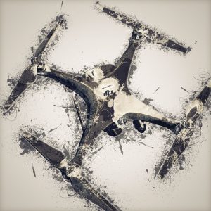
 We are using cutting edge drones, full frame digital format cameras and have stumbled onto a market in need of drone technology. We can currently provide commercial drone: photography, videography, 3D photomosaic mapping. We are also putting the finishing touches on drones for optical gas imaging (hydrocarbon), and NDVI equipped birds for vegetative analysis.
I aint jack productions
Drone pilot services
Cutting Edge Drone Technology
Optical Gas Imaging
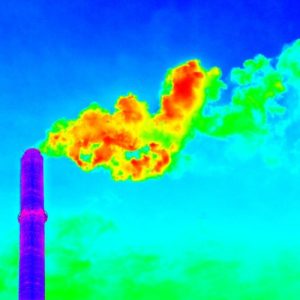 Our OGI capabilities are coming soon. This is a service that will be provided to the Oil and Gas Industry for EPA LDAR (Leak Detection And Repair) compliance. We can also perform AVO (Audio Visual Olfactory) inspections of well locations and production facilities. Utilizing drone technology we can get inspections done faster, while eliminating the inspector from hazards associated with fugitive gas emissions.
Agricultural - Botanical
Top-notch service & optimal price
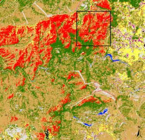 Agricultural/ botanical. Utilizing advances in thermal imaging we use a drone platform for crop and rangeland surveys. This is an aerial inspection of crop health and/or botanical invasive species identification.
3D mapping and volumetric measurement
Top-notch service & optimal price
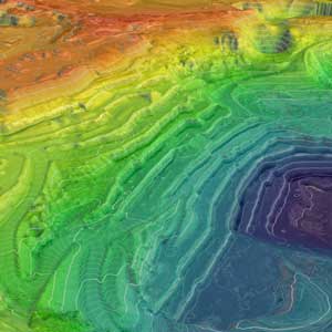 3D mapping and volumetric measurement. We program a drone mission over construction areas, and generate a 3D map for project management, and volumetric measurement. We can also provide overhead photos that are handy for management, presentations, and layout evaluation.
We use a variety of camera equipment to create original video content to fit client needs. This video capture some GREAT moments with some Sharptail Grouse. This was just a Hero 4 Black on a tripod, with a Zoom handycorder.
This was a fun project with my favorite Sheridan, Wyoming massage therapist. No drones used here though. This was shot with a DJI Osmo+ 1080/60, original music too!